Scientific background
Equipment for initiating seafloor geodesy in France and creating a national community of researchers in marine geodesy, through shared national facilities.
MARMOR Project within Activity 1 aims at creating a national community and a new generation of researchers in marine geodesy, not only for solid earth, but also for emerging, non-solid earth applications.
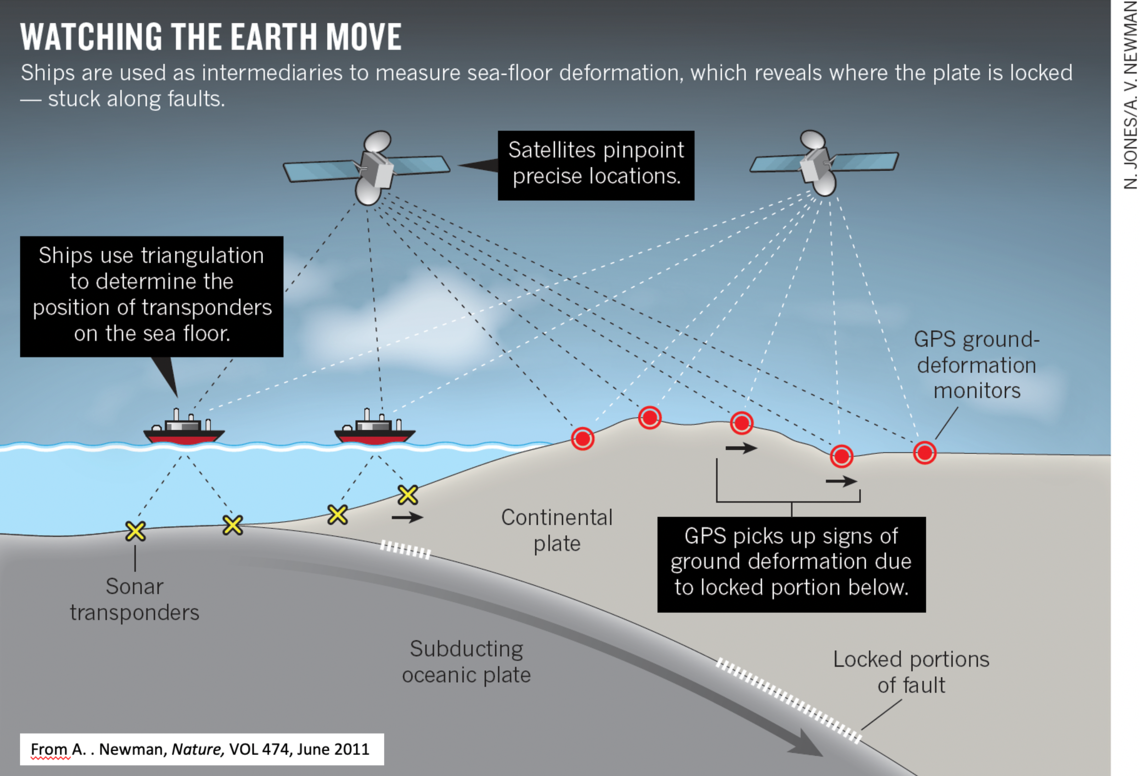
Surface displacements (vertical and horizontal) are the most direct observations of slip along fault or magma intrusion at depth. Fundamental questions like the ability for the shallowest part of fault to store elastic energy for future tsunamogenic earthquakes, the existence and characteristics of shallow slow slip events or the role of fluid in underwater faults have yet to be answered.
On land, Global Navigation Satellite System (GNSS) networks have largely contributed to improve our global understanding of tectonic deformation processes. For instance, they have allowed the discovery of slow-slip events (SSEs), revealing that a variety of fault slip behaviours are at work at subduction zones. To date, however, land-based geodetic networks only provide access to those SSEs occurring at 20 to 40 km depth in subduction contexts. Access to shallower events (<15 km depth, e.g. where tsunamigenic earthquakes occur) via geodetic methods is almost impossible today, in absence of suitable seafloor geodetic methods

